- 3D GAUSSIAN SPLATTS POINTCLOUDS PHOTOGRAMMETRY
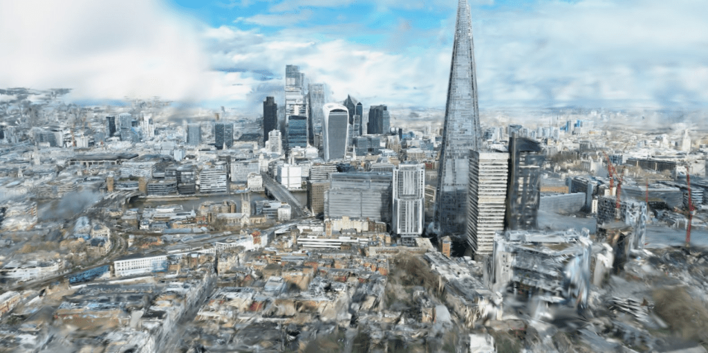
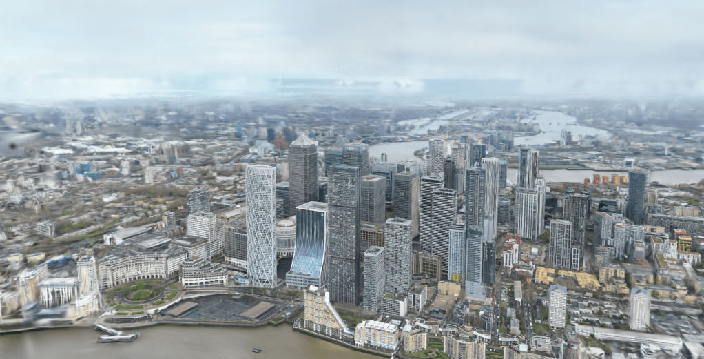
- LONDON
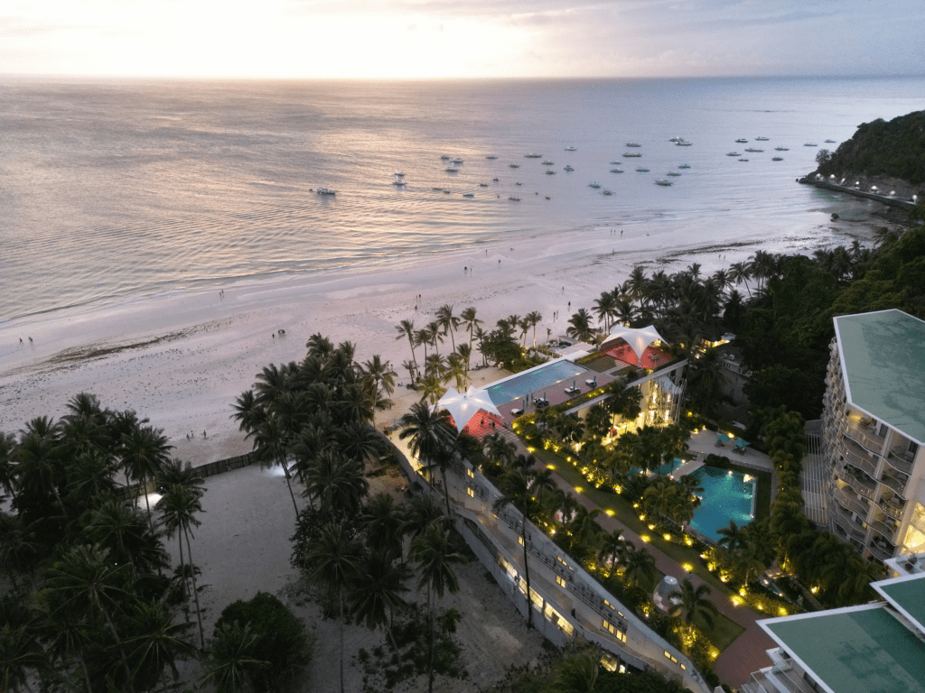
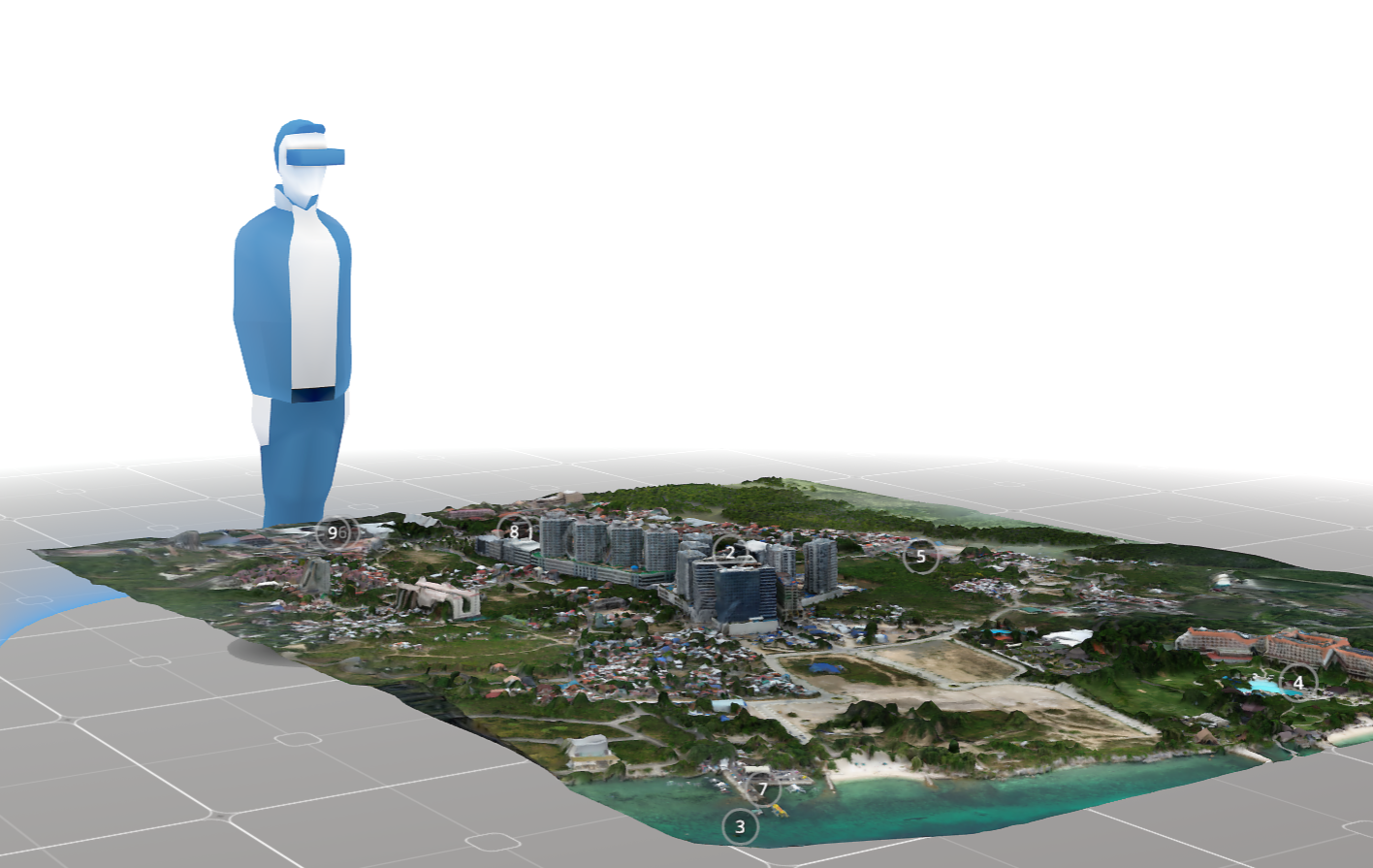
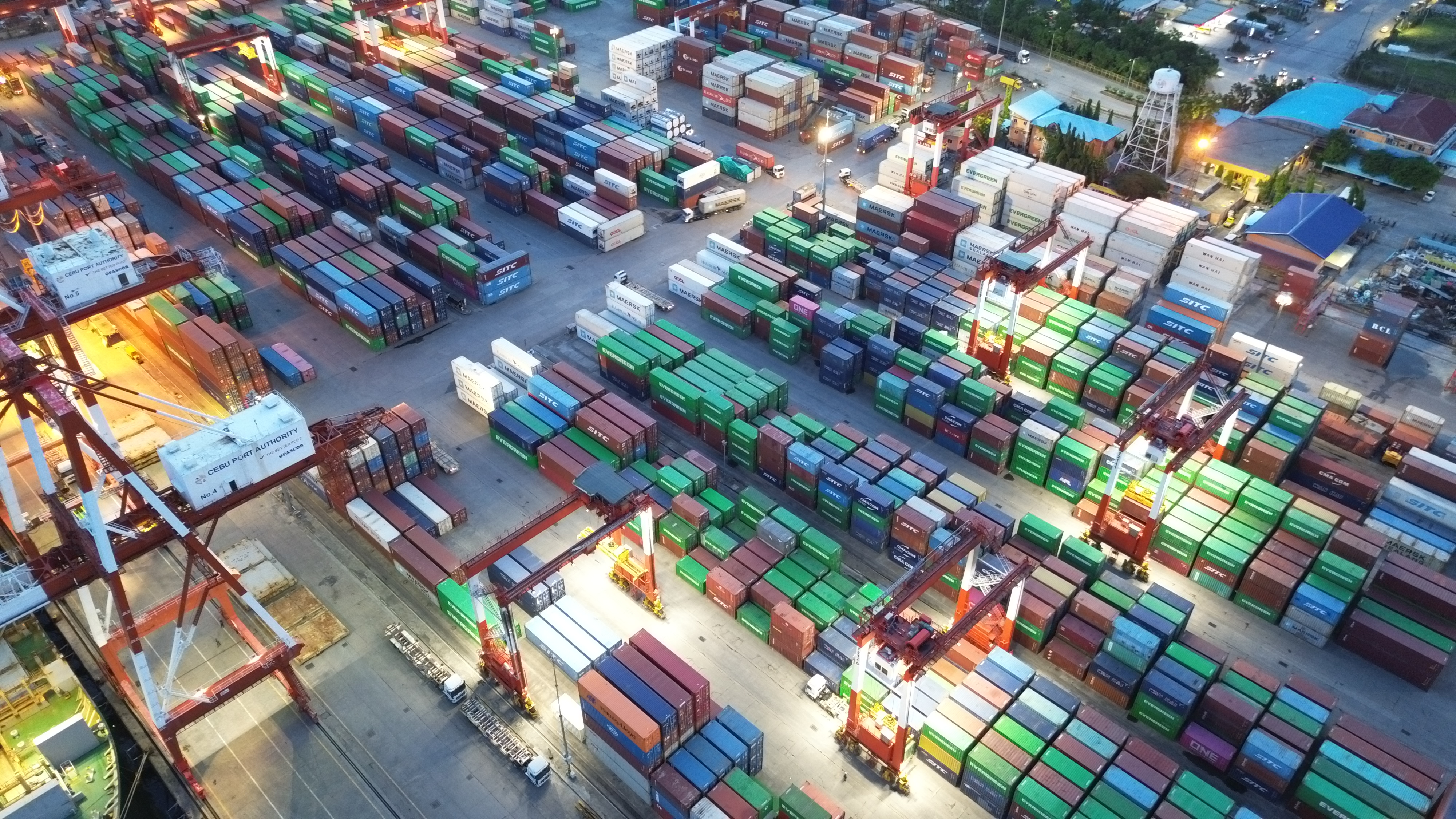
- SE ASIA Philippines
- 3D VISUALIZATION / MAPS / FLIGHT MISSION PLANNING
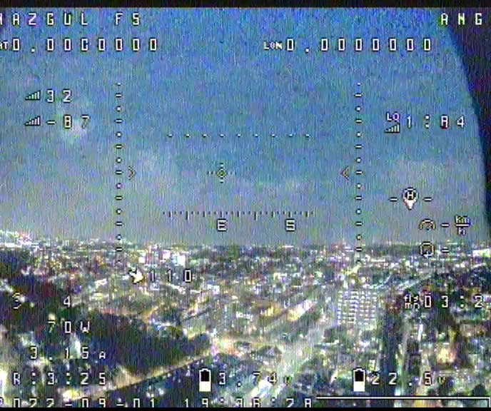
- AERIAL VIDEOGRAPHY
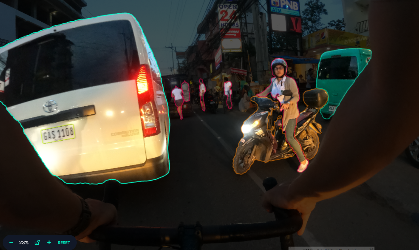
- DATASETS / IMAGE ANALYSIS
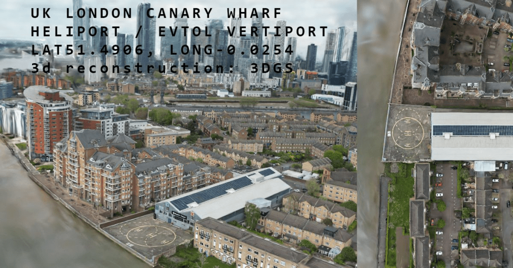
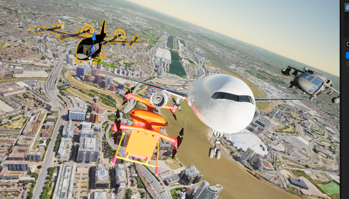
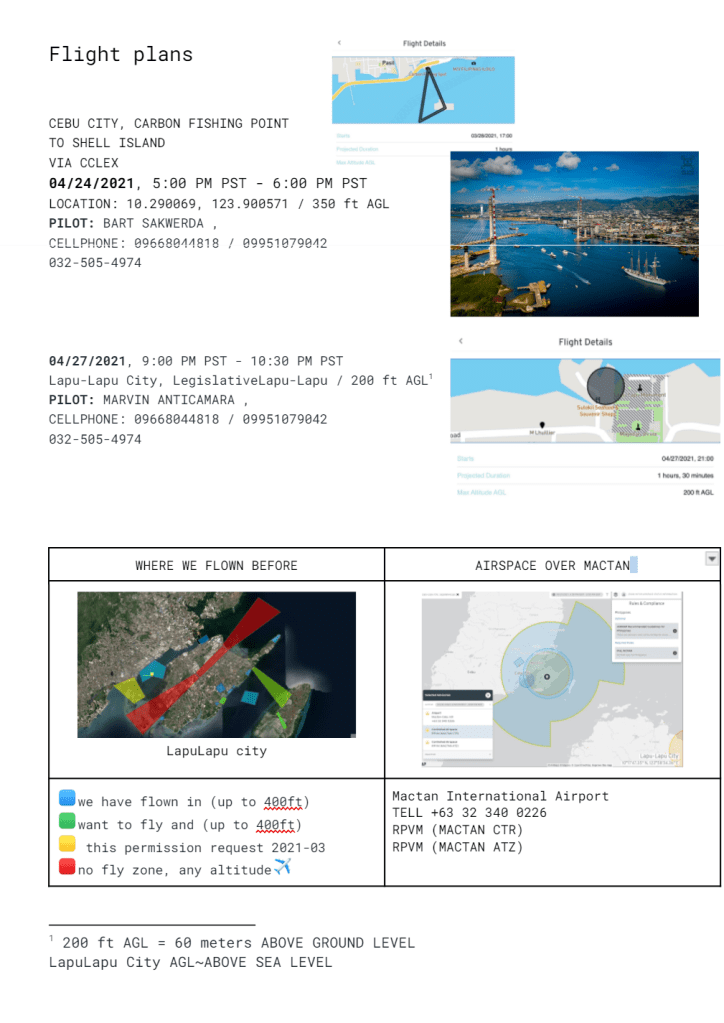
- AIRPSPACE / FLIGHT PATH MAPPING FOR EVTOL
- UK SKYPORTS AND ADVANCED AIR MOBILITY
- Links to reference sites:
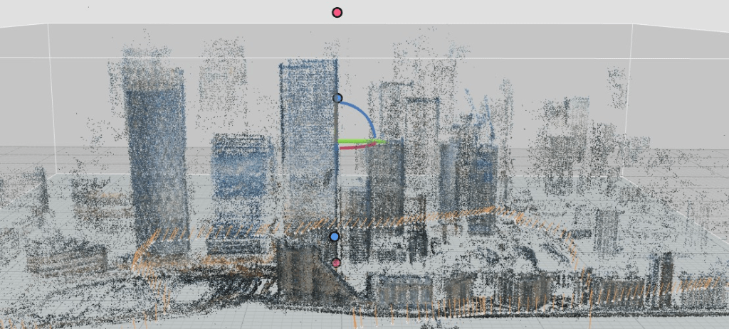
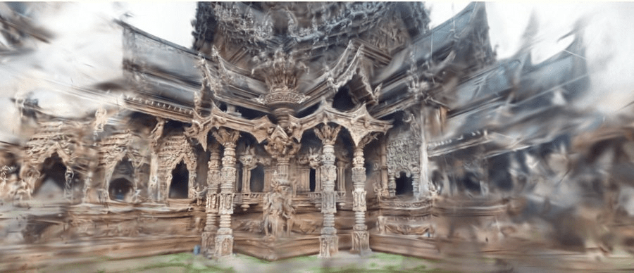
3D GAUSSIAN SPLATTS
POINTCLOUDS
PHOTOGRAMMETRY
Article about how i got into drones https://medium.com/@BartSakwerda/how-i-got-into-commercial-drone-surveys-c95c12773c9b
Some images from UAS flights and surveys grouped by the country.
text only list here here
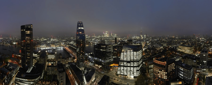
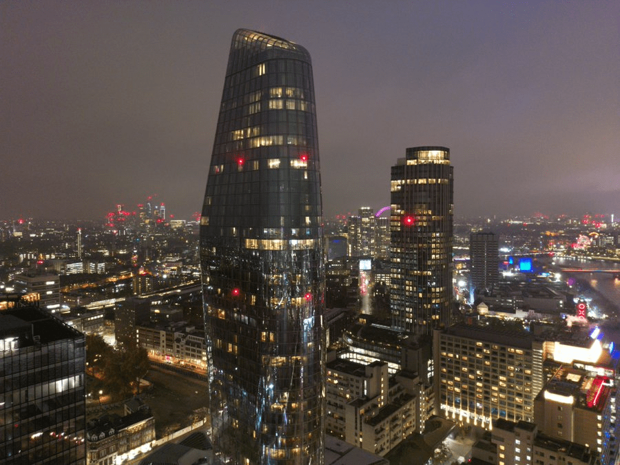
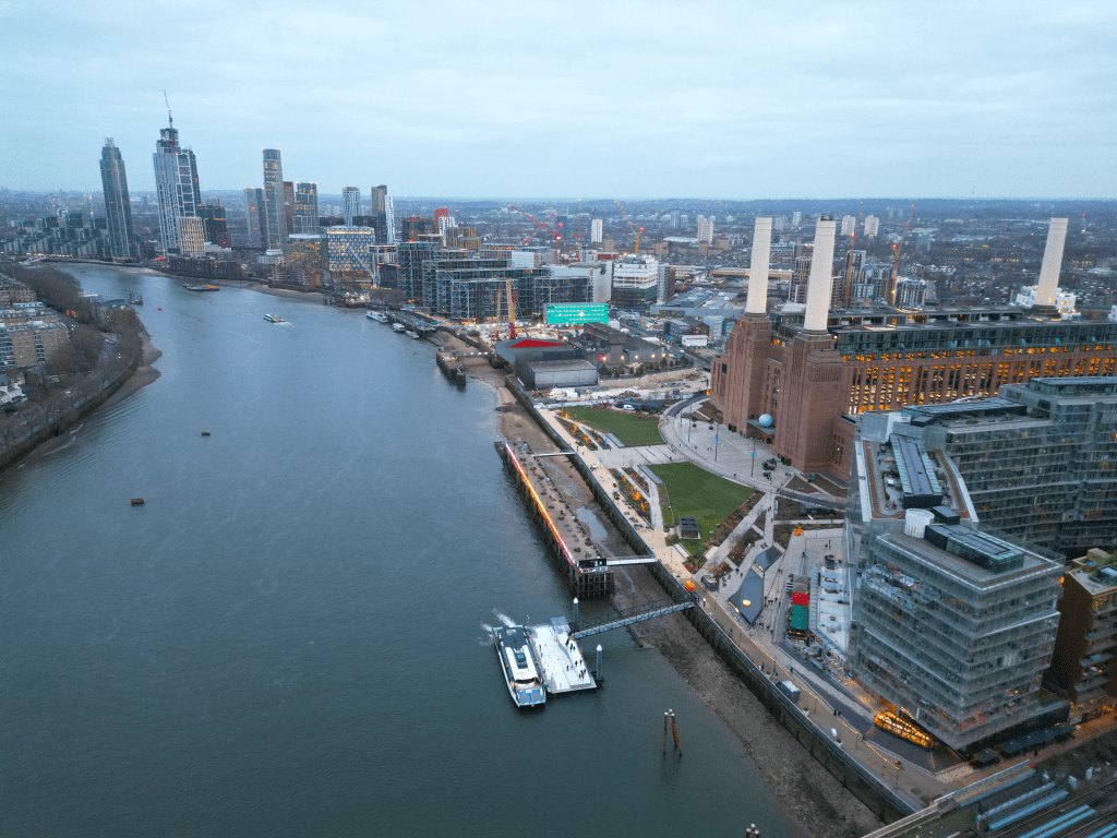
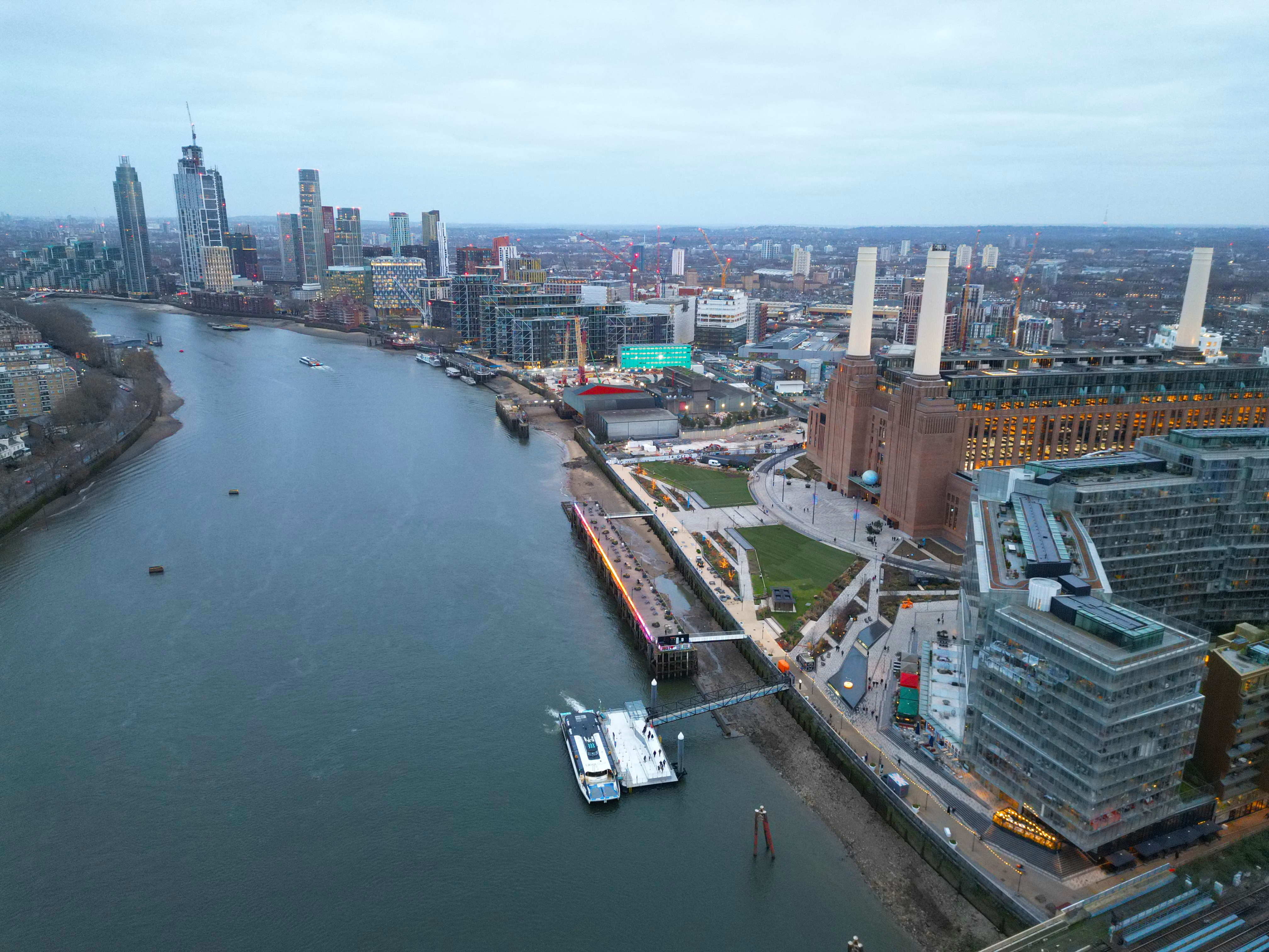
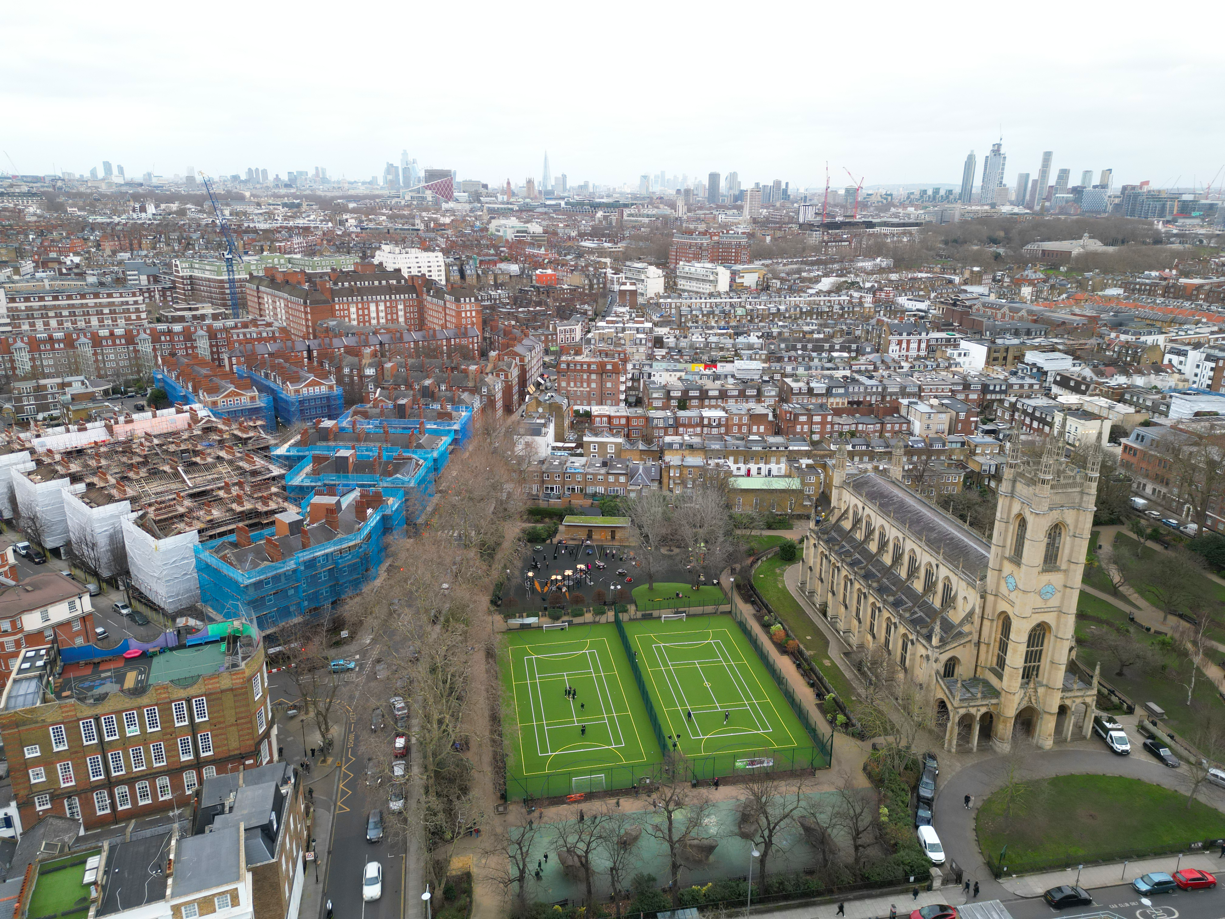
LONDON
‘Gaussian Splatts’ shot in London by Bart Sakwerda 2022-2024
I have moved from photogrammetry to NERFs, then when published for the first time in 2023, I have started to process my datasets as 3DGS. My captures were featured by online processor and hosting companies i.e. by Lumalabs.ai or PolyCam.
List https://bartsakwerda.com/2025/01/09/list-of-gaussian-splatts-uk-and-london/ full list here
Presentation https://slides.com/d/x5Tf8Vc/live


UK SKYPORTS AND ADVANCED AIR MOBILITY
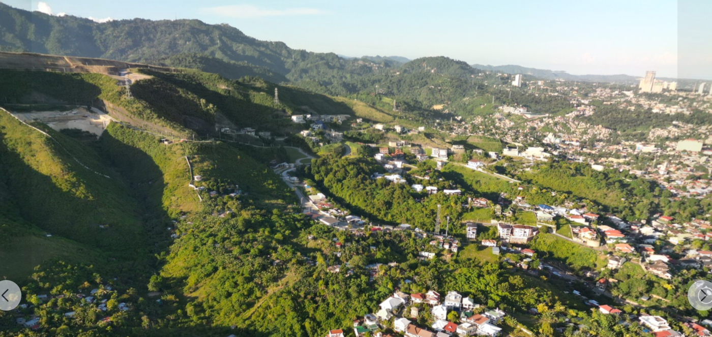
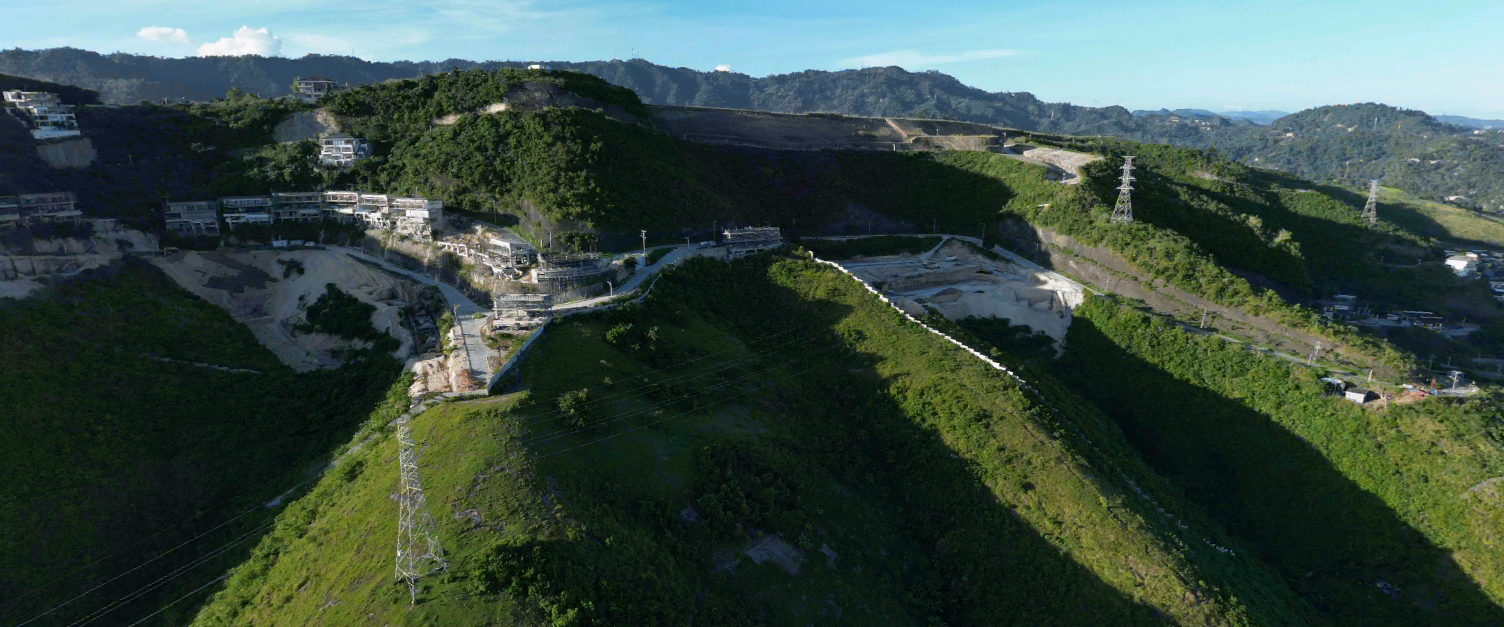
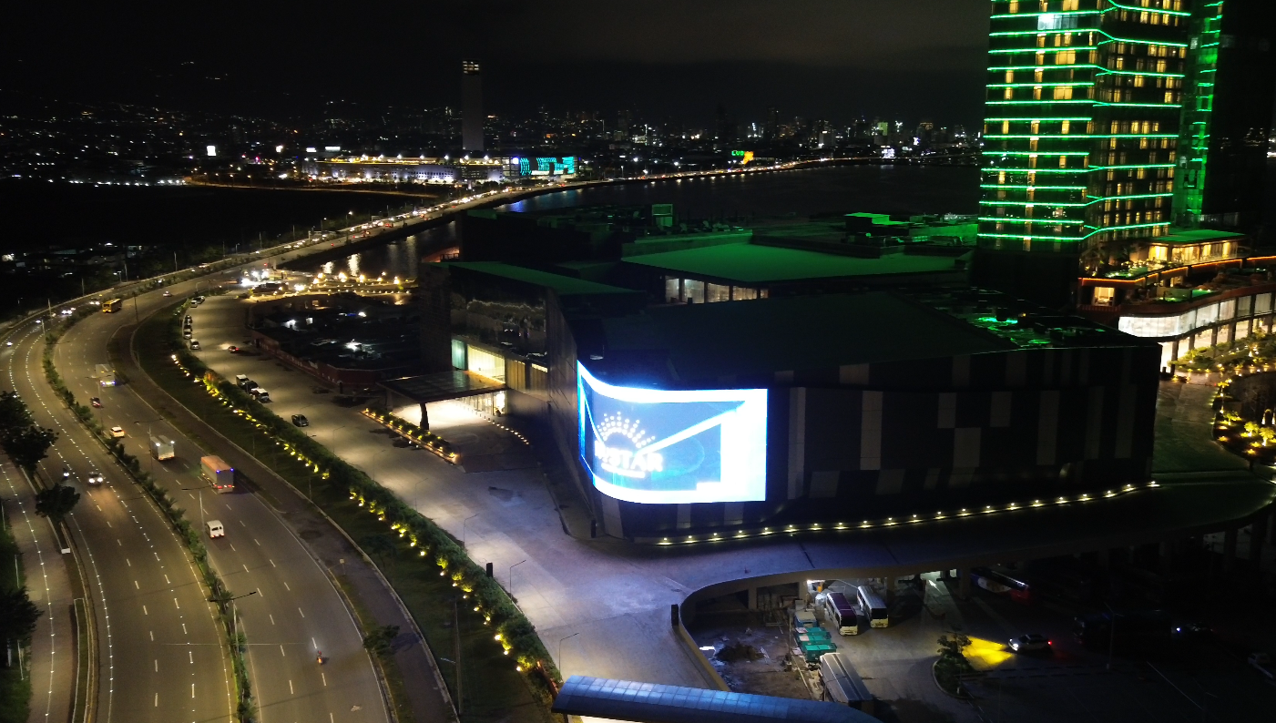
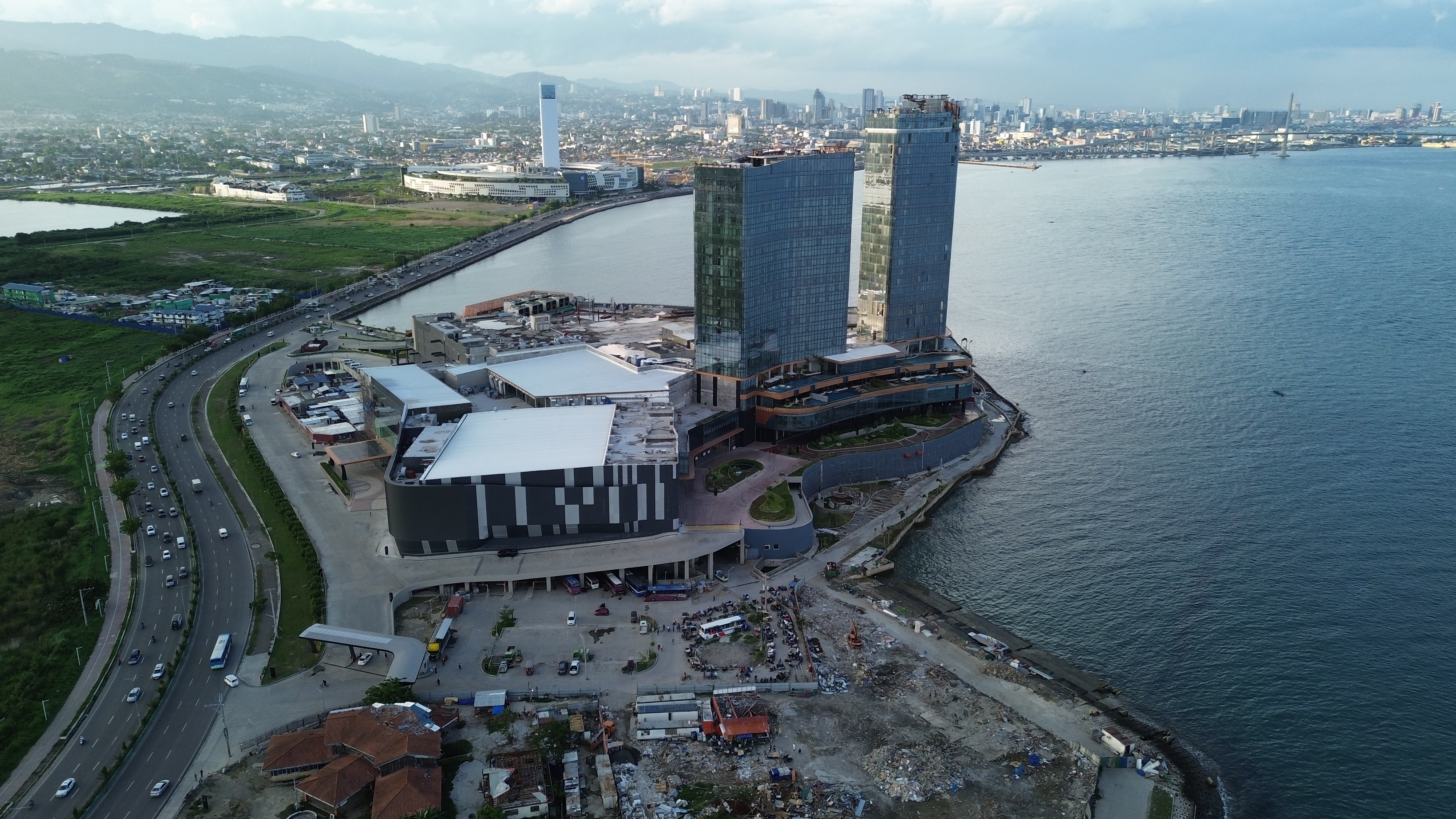
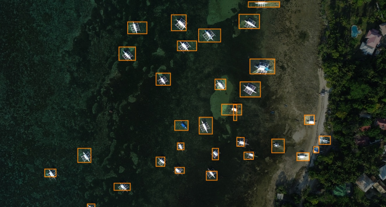
SE ASIA Philippines
https://twitter.com/Polycam3D/status/1681716133248860161
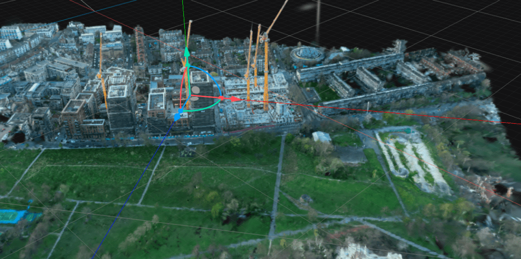
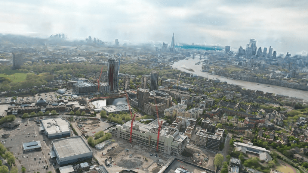
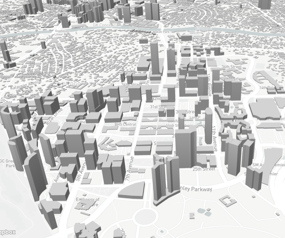
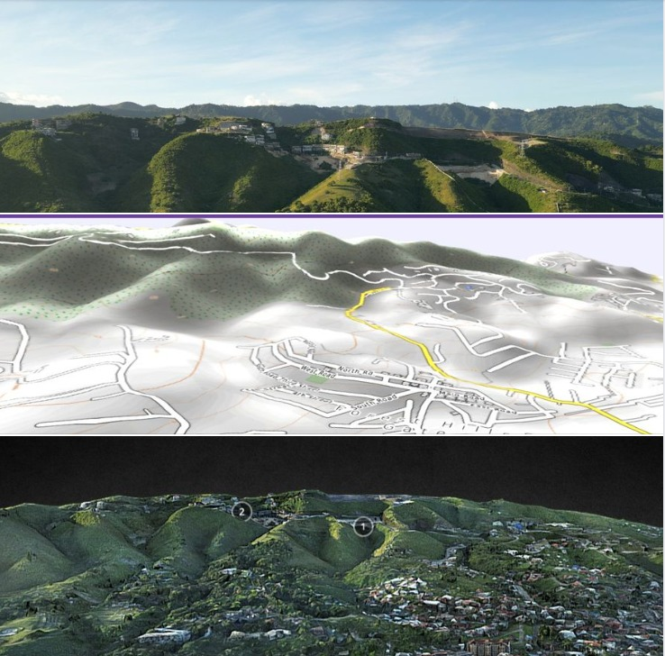
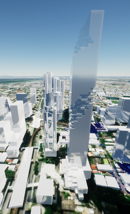
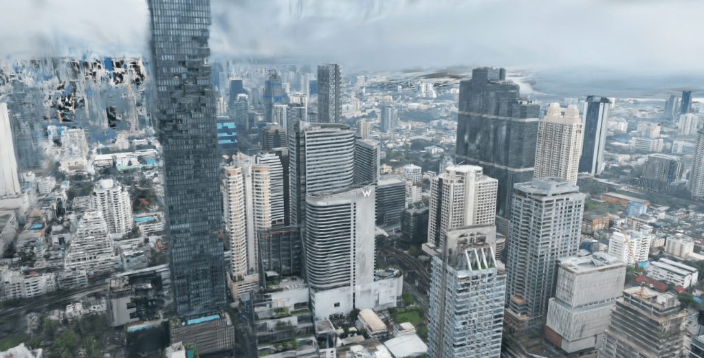
3D VISUALIZATION / MAPS / FLIGHT MISSION PLANNING
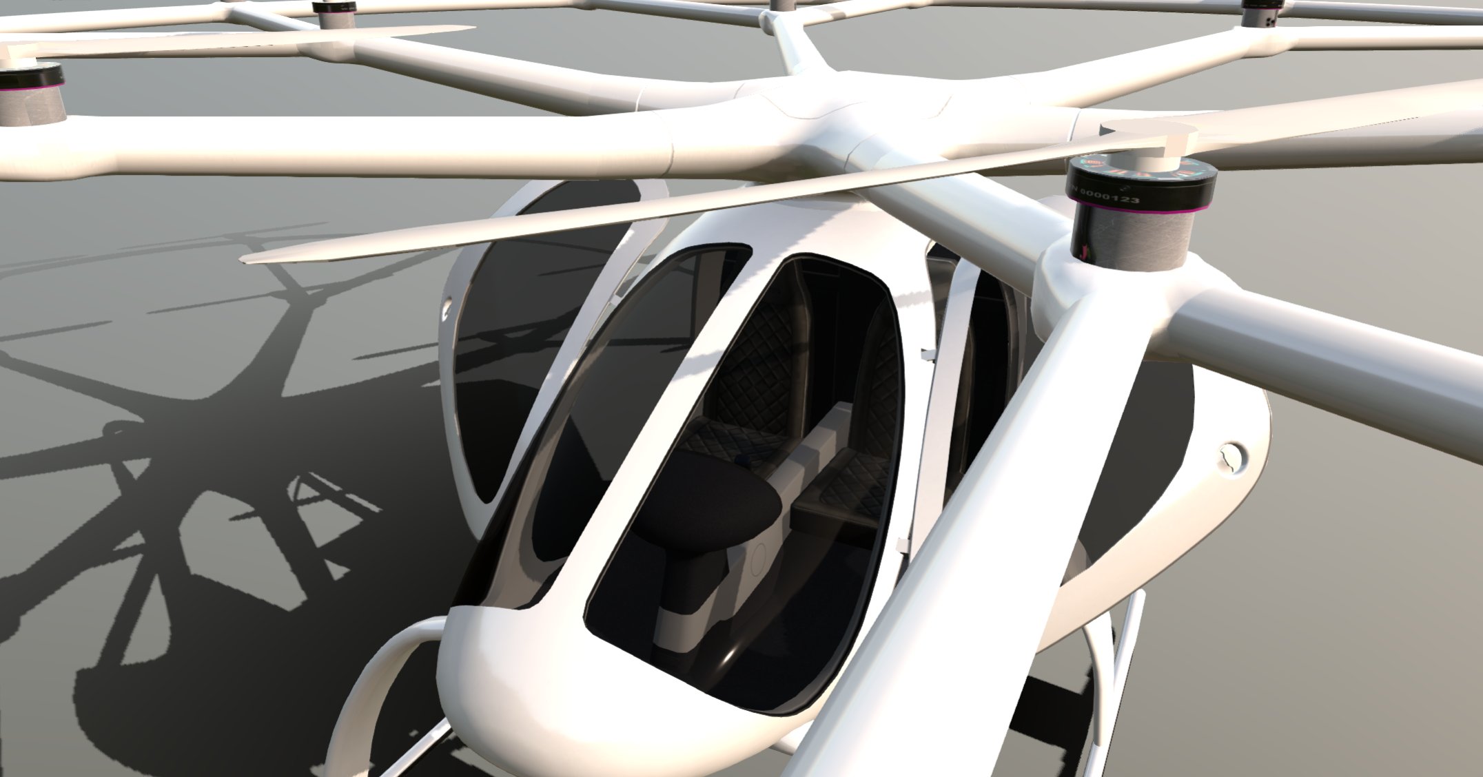
I have made seval 3d visualizations of the Advanced Air Mobility in Londonand other places. Indlucidng (now bancrupt) Velocopter and Joby Aviation VTOL vehicles.
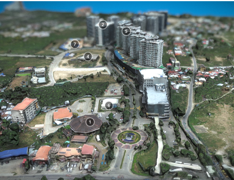
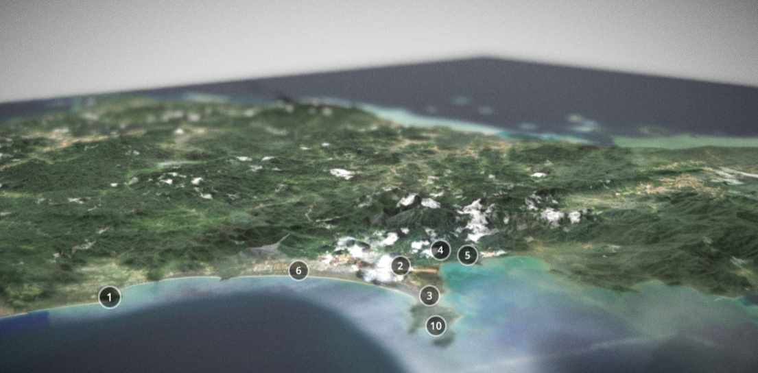
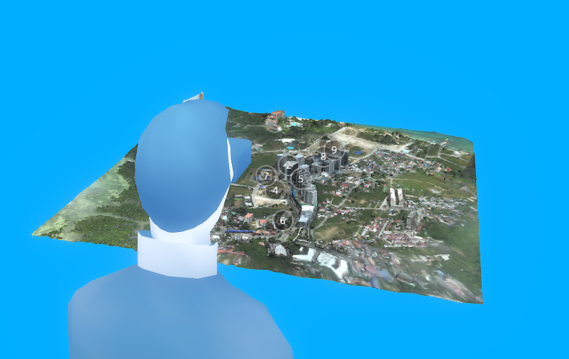
Mapped terrain in UK (London) and Philippines (Cebu, Metro Manila) and Thailand(Bangkok), that enabeld to plan integration of VTOL, delivery drones the airtraffic. Otherwise terrain and maps mainly used in architecture, construction planning.

AERIAL VIDEOGRAPHY
I have been involved in Aerial Photography since circa 2014, first drone flights over island of Bantayan.
Later with the BUDOTS MEDIA PHILIPPINES (facebook) company


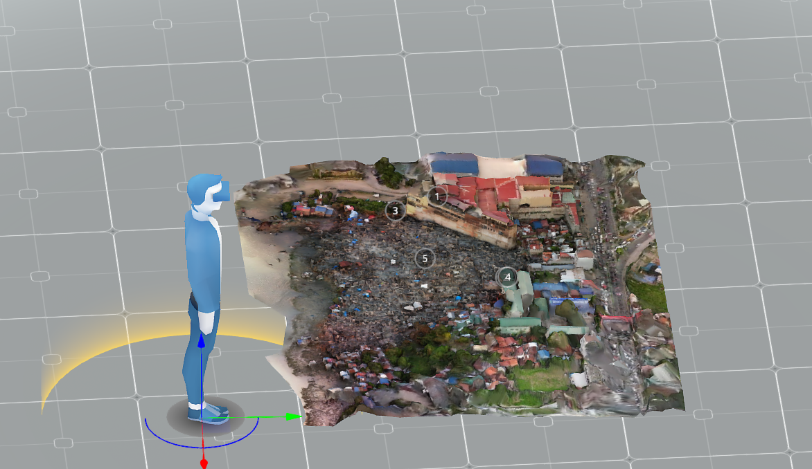
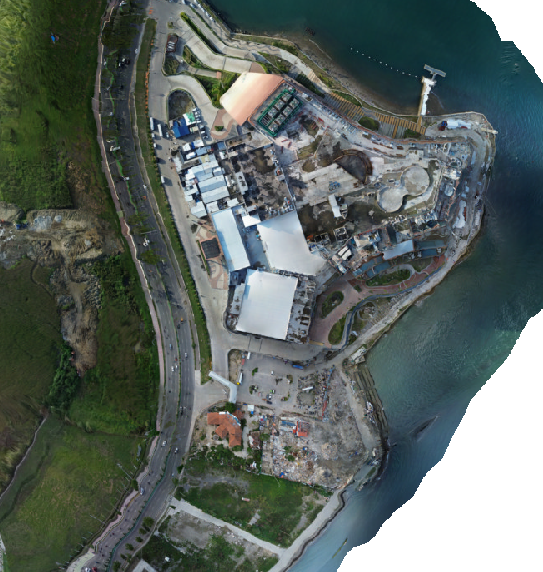
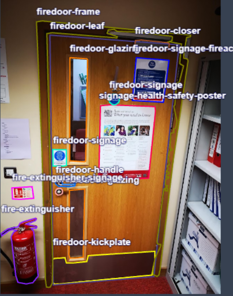
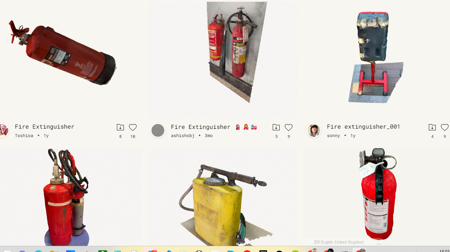
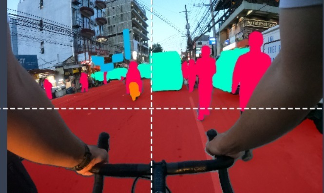
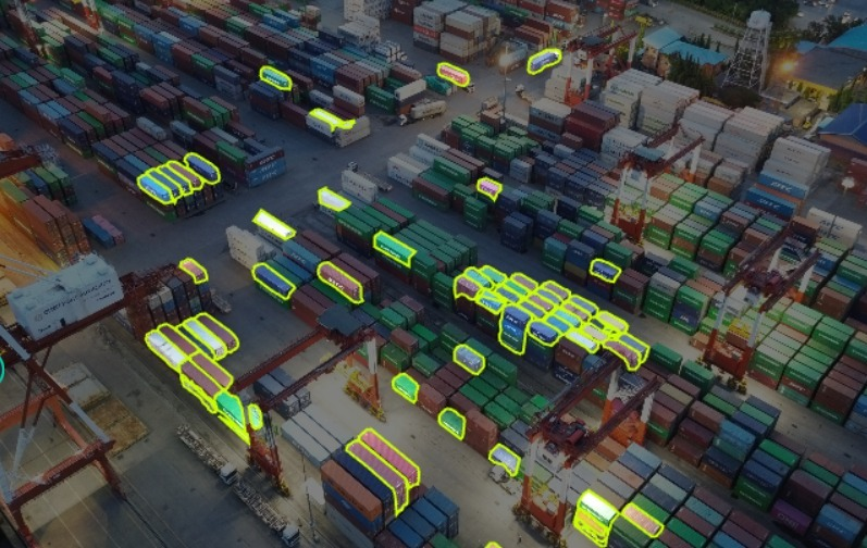
DATASETS / IMAGE ANALYSIS
Related work on the datasets, from aerial drone acquired data form London and Philippines to fire asset pointclouds, fire door component detection.
Most of the projects hosted on kaggle, roboflow.


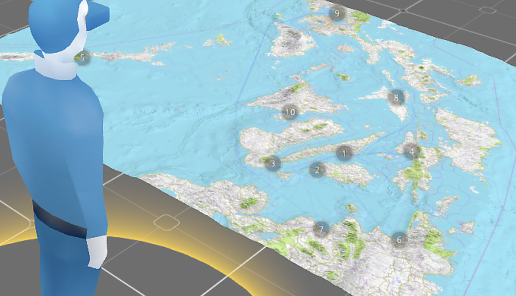
AIRPSPACE / FLIGHT PATH MAPPING FOR EVTOL
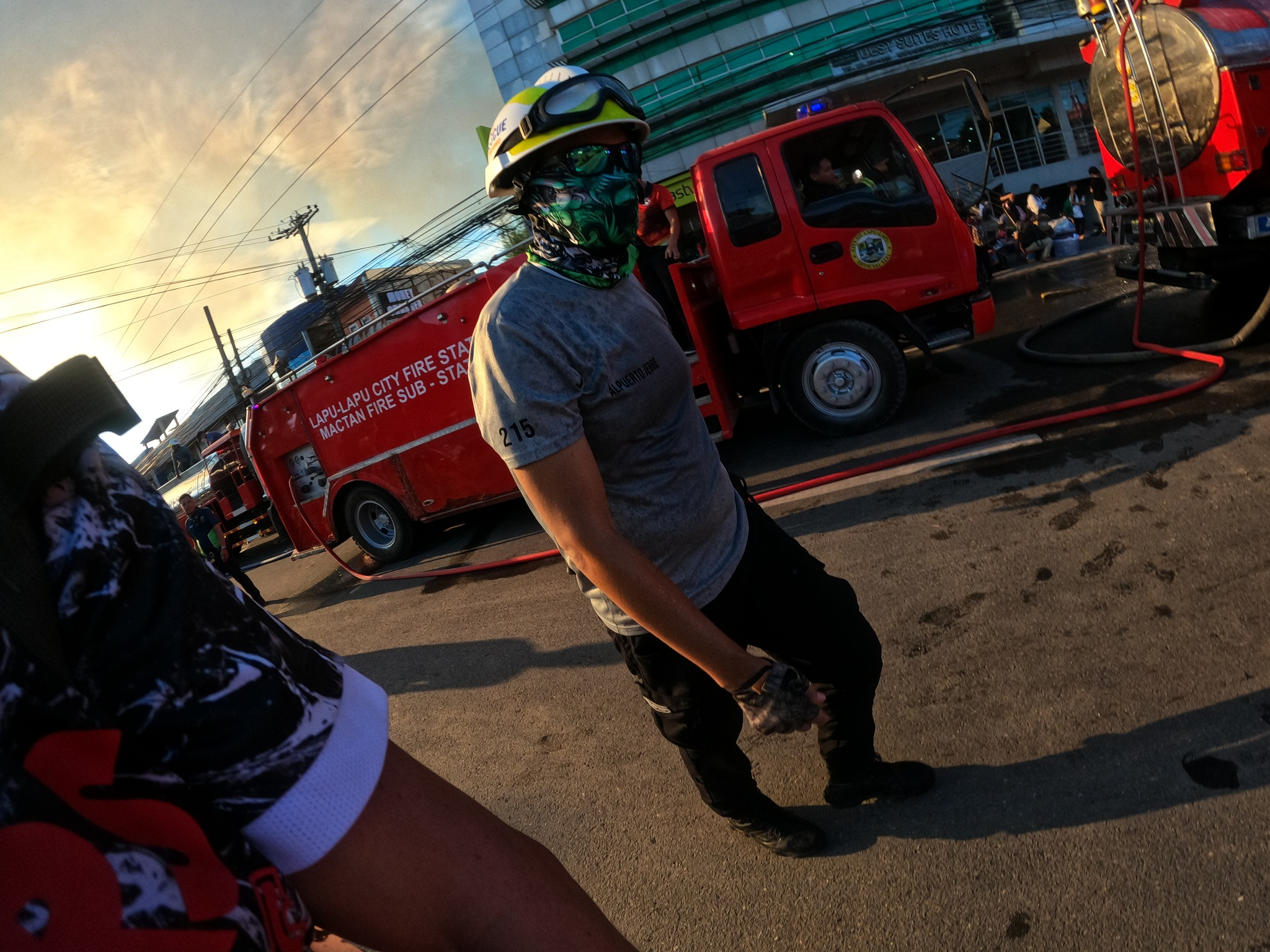
Some samples of mission planning during events suc as CEBU SINULOG or visit of Philippine’s presidents visiting Cebu, LapuLapu loctions.
Other are substantial evewnts like Typhoon Odette, wher Budots Media performed damage assessments

Links to reference sites:
- youtube Drone flights channel
- https://www.linkedin.com/in/bart-sakwerda-sec-fire-drones/
- https://www.facebook.com/aerial.data.ops
- https://poly.cam/@bartsakwerda
- https://slides.com/bartsakwerdauk/bart-sakwerda-drone-scans-london
Mentiones by cloud providers
- https://twitter.com/Polycam3D/status/1777772449330794839
- https://twitter.com/Polycam3D/status/1713967780649648321
- https://twitter.com/Polycam3D/status/1732097262094823711
SE ASIA (MALAYSIA, PHILIPPINES, VIETNAM, THAILAND)
Some splatts form Thailand here
https://twitter.com/BartSakwerda/status/1755837595609636907 DAVAO LANDSLIDE