
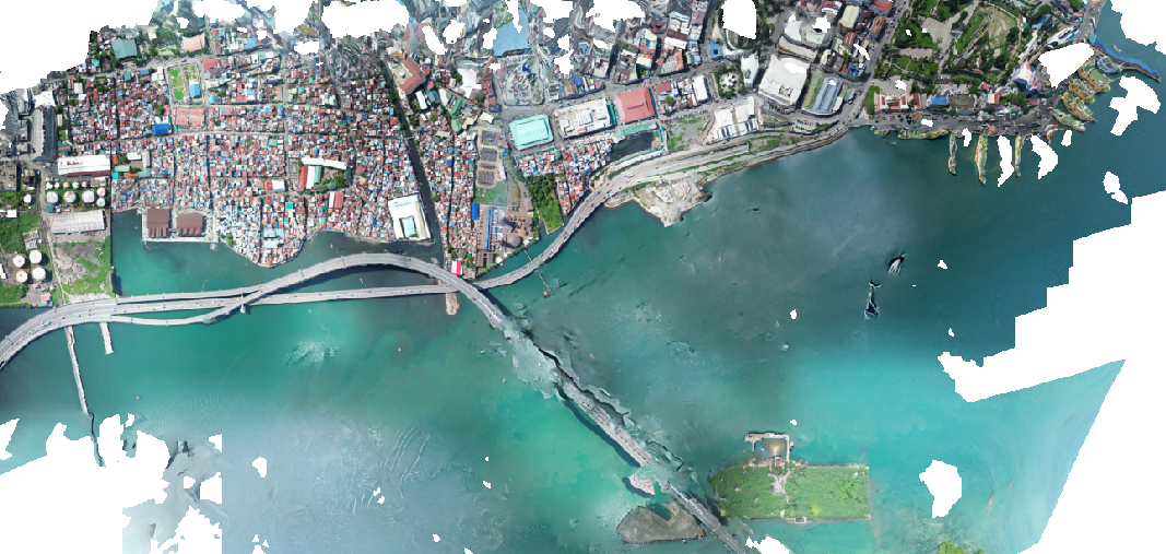
CCLEX is is and iconic bridge in Cebu metro. It passes though variety of environments form mangroves, islets, sea channel to the Cebu SRP reclamation.
We have captured some of the the Bridge features for the purpose of photogrammetrical reconstruction of the terrain and structural features of the bridge.

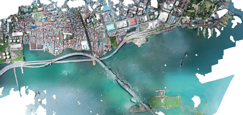

NUSTAR is a leisure complex with located between SRP highway and the reclamation sea shore. More about Nustar in a separate Article.
More context
The Cebu-Cordova Link Expressway (CCLEX) connects the South Road Properties (SRP) in Cebu City with Cordova on Mactan Island. It opened in 2022 and is roughly 8.9 km long. Along the way it crosses mangroves, small islets, the sea channel and the SRP reclamation, which makes it a good subject for drone photogrammetry.
The captures here were used to rebuild terrain and structural features of the bridge as orthomosaics and low-poly 3D models. Models like these can be used for maps, progress monitoring, visual communication and, with enough ground control, measurement. For drone mapping or 3D scanning of infrastructure in Cebu, contact Budots Media.
Related
- Tracking progress of Cebu construciton projects. 2023
- Huge potential of Nustar Cebu as a public venue and advertising space.
- Mapping Cebu in all dimensions.
- Importance of Digital Twins and Regular 3D Scans of Buildings
- DJI drone 3D production: from flight to Gaussian splat
- Drone Surveys & Aerial Datasets
Translations
Polski
CCLEX (Cebu-Cordova Link Expressway) łączy South Road Properties w mieście Cebu z Cordovą na wyspie Mactan. Most otwarto w 2022 roku, ma około 8,9 km długości i przebiega przez namorzyny, wysepki, kanał morski i tereny zrekultywowane SRP. Uchwyciliśmy dronem fragmenty mostu, aby metodą fotogrametrii odtworzyć teren i elementy konstrukcji jako ortomozaiki i uproszczone modele 3D. We wpisie widać też ortomozaikę SRP z kompleksem Nustar i jego ekranem LED. Takie modele służą do map, monitorowania postępu prac i komunikacji wizualnej.
日本語
CCLEX(セブ・コルドバ・リンク・エクスプレスウェイ)は、セブ市のサウスロード・プロパティーズ(SRP)とマクタン島のコルドバを結ぶ全長約8.9kmの橋で、2022年に開通しました。マングローブ、小島、海峡、SRPの埋立地を通過します。私たちはドローンで橋の一部を撮影し、写真測量によって地形と構造をオルソモザイクやローポリ3Dモデルとして再構築しました。記事にはNustarリゾートを含むSRPのオルソモザイクや、その大型LEDスクリーンの写真もあります。こうしたモデルは地図、工事進捗の記録、視覚的な説明に活用できます。
Filipino
Ang CCLEX (Cebu-Cordova Link Expressway) ay nagdurugtong sa South Road Properties (SRP) ng Cebu City at sa Cordova sa Isla ng Mactan. Binuksan ito noong 2022 at humigit-kumulang 8.9 km ang haba, dumadaan sa bakawan, maliliit na isla, kanal ng dagat at reclamation ng SRP. Kinunan namin ng drone ang ilang bahagi ng tulay para muling buuin sa photogrammetry ang lupain at istruktura bilang orthomosaic at low-poly na 3D model. Kasama rin ang orthomosaic ng SRP at Nustar at ang LED screen nito. Magagamit ang ganitong model sa mapa, pagsubaybay sa konstruksyon at visual na komunikasyon.
العربية
يربط جسر CCLEX (طريق سيبو-كوردوفا السريع) منطقة South Road Properties في مدينة سيبو ببلدة كوردوفا في جزيرة ماكتان. افتُتح عام 2022 ويبلغ طوله نحو 8.9 كم، ويمر عبر غابات المانغروف والجزر الصغيرة والقناة البحرية وأراضي SRP المستصلحة. صوّرنا أجزاء من الجسر بالطائرة المسيّرة لإعادة بناء التضاريس والعناصر الإنشائية بالتصوير المساحي في صورة خرائط مصححة ونماذج ثلاثية الأبعاد مبسطة. تتضمن التدوينة أيضاً خريطة لمنطقة SRP ومجمع Nustar وشاشته الكبيرة. تفيد هذه النماذج في الخرائط ومتابعة الأعمال والتواصل البصري.


3 thoughts on “Scanning CCLEX bridge in Cebu Philippines. 3d model”